
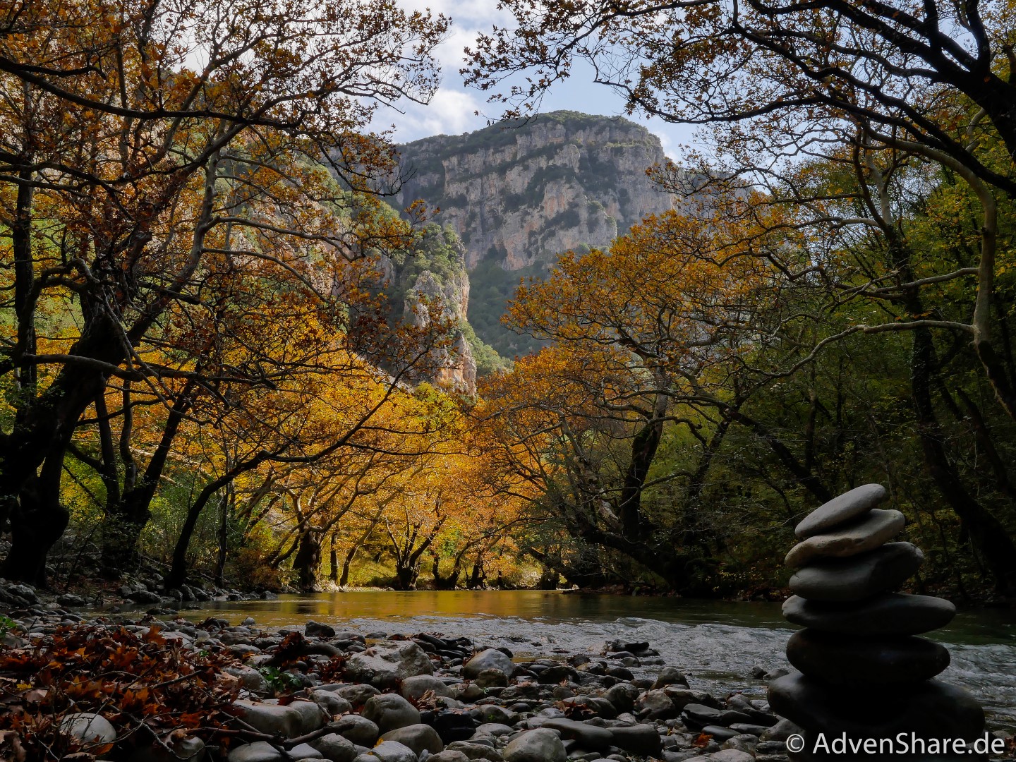
Unweit hinter der albanischen Grenze am Rand des Dorfs Klidonia in Griechenland gibt es einen offiziellen Wohnmobil-Stellplatz. Dieser ist eine perfekte Basis für die Besichtigung der Klidonia Brücke und der anschließenden Schlucht-Wanderung. An wärmeren Tagen bietet sich der Fluss außerhalb des Nationalparks für eine Abkühlung an. Das Gebiet ist nicht nur wegen seiner geschützten Diversität so faszinierend, auch der geschichtliche Hintergrund lässt staunen.
[infobox maintitle=“Follow our fulltime vanlife adventure! “ subtitle=“Begleite uns zu den schönsten Plätzen in Europa, bei unseren sportlichen Abenteuern und dem ganzen Drumherum.“ bg=“green“ color=“black“ opacity=“on“ space=“30″ link=“https://advenshare.de/category/europa-reise/“]
Route (↑↓260 hm, 12.5 km)
Parkplatz Klidonia Bridge – vor der Brücke links dem Pfad folgen – zurück zum Parkplatz
Datum
6. November 2019
Charakter
T2- Leichte Wanderung, gut beschildert. Meist schmaler Wanderweg, manchmal etwas steinig und abschüssig.
Tourenbeschreibung


„At around 14,000 years ag0, after the last global peak of the ice extent, palaeolithic archers used Boila as a temporary summer hunting station. On the sandy bank of the Voidomatis, which previously cascaded against the southern wall of the gorge, these nomadic people left relics ashes and charcoal] of the camp fires they lit for protection against carnivores, such as wolves and lynx, and cooking of food, mainly wild goat chamoisj and venison as well as fish. From the river banks they collected pebbles of flint, a hard rock, with which they manufactured a gamut of tools and weapons. With beads made of deer teeth and smail marine shelis, the latter a sign that during other times of the year they lived by the coastline of the lonian Sea, they decorated their bodies and/or leather clothes, footwear and containers. When the forest grew thicker, some 9,000 years ago, covering even the surrounding highlands, the gorge became less attractive to the mobile hunter-gatherers.“


„One of the most complex drainage systéms in Greece is that of the Voidomatis-Aoos. Its millennia long evolution is directly related to the global palaeoclimatic changes and oscillations and the behaviour of ice sheets which at times covered the higher grounds of the Timfi massif. During cold periods, the river volume was much larger and the current much stronger, while different than today were the suspended materials. A relic of an ice-driven river (c. 80,000 -20,000 years ago, which then flowed as much as 15m higher, is this old terrace. Similar geological formations can be seen at various places along the Voidomatis banks. When such harsh conditions prevailed, they prevented the systematic penetration of animals and by extension palaeolithic hunters in the narrow and inhospitable gorge.“


[media] [/media]


Hat dir dieser Beitrag gefallen oder hast du noch Fragen? Dann lass doch einen Kommentar da.
